“As upbeat, jazzy music sets the mood for fun, a happy family in roller skates finishes the match point of a hockey game played out on a strip of nondescript tarmac. Thus begins Swiss-French filmmaker Ursula Meier’s debut feature, Home—in stark contrast to what lies ahead. Marthe (Isabelle Huppert), Michel (Olivier Gourmet) and their three children live a peaceful existence in a remote house that borders a long-unused stretch of highway. When the route one day suddenly opens to commuters, this bohemian clan’s daily routine is thrown into disarray: Ever-sunbathing Judith (Adélaïde Leroux) must endure the catcall honking that overpowers her portable stereo, while it quickly becomes impossible for the younger children, Julien and Marion, to safely “cross the street” to catch their school bus. What begins as annoyance and inconvenience, however, soon crosses over into paranoia, as the incessant traffic noise leads to sleep deprivation and fears concerning prolonged exposure to exhaust loom large. Refusing to relocate, and in an obstinate yet futile attempt to maintain some semblance of the normality they once enjoyed, Marthe and Michel increasingly resort to isolationism and a literal blockade. Alternately tense, touching, absurd and frightening, Home is an invasion movie of another sort—where the space crafts are vehicles and the aliens are ordinary motorists. With its unique style, dark humor and tragic-hopeful denouement, Meier’s film is sure to be one of the most discussed of the Festival. “ --Jeremy Quist, SFIFF
Friday, April 30, 2010
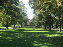
Home
Thursday, April 29, 2010
Wednesday, April 28, 2010
A race to the bottom

Their have been plenty of residual problems because of the housing bubble and it's bust. When housing becomes just another commodity, construction standards lack to improve the developer's bottom line. The South Loop of Chicago know this all to well since many of the new condos that were built their are now in need of major repairs.
From NY Times article:
The view from Tom and Jane Justic’s eighth-floor condominium in the South Loop — with Soldier Field in the foreground and majestic Lake Michigan behind it — is exactly what they were looking for when they moved from Beverly in 2005.But the condominium that came with that view has an unexpected and unwelcome additional cost: $850 a month in special assessments for the next five years, to cover the expense of building repairs that were completed late last year.Since it was constructed in 2002, the Justics’ 23-story building at 1717 South Prairie Avenue has become an extreme example of the strains and pains that many South Loop condominiums and town houses now face from the area’s boom in construction before the market collapsed in late 2008. Once one of the city’s hottest real estate markets, the South Loop is crisscrossed by scaffolding and suffused with the frustration and anxiety of litigation between condo boards and developers.
Just another after effect of the housing boom rears its ugly head. Just how many more problems are still expected as a result of our race to the bottom?
Tuesday, April 27, 2010
Two Wheel Tribes: Stereotypes part II

A few weeks ago I posted about the common stereotypes that are created of those that use two wheels as a main mode of transportation. Well, of course the NY Times just can leave bike culture, oh I mean, The two wheel tribe alone. In usual fashion if you ride a bike you must be a roadie, crazy messenger, NYCDOT commish, or some sort of weirdo.
So what does cycling culture look like? Is it dodging through gritty traffic, or rapidly pedaling around Central Park? Are the track-bike tribes of Williamsburg more or less native than those of the mountain bikers in Highbridge Park? What about the fashion plate on a $1,200 Dutch bike, or a pedicab driver who recently arrived from Tajikistan?
Listen to the profiles of these five two wheel wielders here. As usual the comments section is where everyone fights for their small part of turf in NYC.
Friday, April 23, 2010
Business Planning: Martin J. Chavez on PlaNYC

Planner and scholar Tom Angotti wants more local and community input to PlaNYC, Martin J. Chavez thinks Mayor Bloomberg did an excellent job and created a model worth replicating in other cities:
Both Chavez and Angotti have a point, but who is right? Having worked in NYC on many levels and dealing with numerous city bureaucracies I would say they both have a point. We need city departments to function better together and not different silos, but at the same time, we do need better engagement of our communities in regards to creating and sustaining more livable cities. I do firmly believe we need innovation, but in a comprehensive manner that incorporates everyone. City staff can sometimes be the most disengaged folks to work with which causes good ideas to go unimplemented.
This process required a new level of coordination between City departments that didn’t previously exist. All too often in municipalities, as in any organization, projects and programs are siloed within departments that don’t communicate. To resolve this, the Mayor created the Mayor’s Office of Long-Term Planning and Sustainability, a central office to drive the creation of PlaNYC and manage collaboration between departments. Cooperation wasn’t optional, since Mayor Bloomberg made clear his personal commitment to the plan.
But Mayor Bloomberg took care not to over-manage the process from the top down. Instead, he hired the most talented staff he could find and encouraged a culture of innovation, empowering city staff to experiment with new ideas—and giving them permission to be bold and take risks. This is a major distinction to the business-as-usual approach so common in jurisdictions around the country.
The good news is that a culture of innovation isn’t unique to New York, and is taking root in cities from Cleveland and Chicago to Las Vegas and my own Albuquerque. We’re all sharing and implementing the best ideas wherever we can find them. The imperative is to deal with issues like climate change and energy independence now, and make our communities even better places to live for our children and grandchildren.
Both Chavez and Angotti have a point, but who is right? Having worked in NYC on many levels and dealing with numerous city bureaucracies I would say they both have a point. We need city departments to function better together and not different silos, but at the same time, we do need better engagement of our communities in regards to creating and sustaining more livable cities. I do firmly believe we need innovation, but in a comprehensive manner that incorporates everyone. City staff can sometimes be the most disengaged folks to work with which causes good ideas to go unimplemented.
Thursday, April 22, 2010
Wednesday, April 21, 2010
Elite Cities?

This article in The Economist about Portland as an elite city caught my eye the other day. The premise is that as your city becomes more livable, sustainable, and healthier - well so does the cost of living which eventually wipes out the middle class. While that might be true for Portland, I am not sure I buy the argument, I do believe this trend has killed the core for cities like New York and San Francisco. Where only the wealthy, and those who work for them, can manage to live, or so it seems of late.
From the article:
Joel Kotkin, a Los Angeles-based demographer and author, thinks that places like Portland, San Francisco and Boston have become “elite cities”, attractive to the young and single, especially those with trust funds, but beyond the reach of middle-class families who want a house with a lawn. Indeed Portland, for all its history of Western grit, is remarkably white, young and childless. Most Americans will therefore continue to migrate to the more affordable “cities of aspiration” such as Houston, Atlanta or Phoenix, thinks Mr Kotkin. As they do so, they may turn decentralised sprawl into quilts of energetic suburbs with a community feeling.
That is not to belittle Portland’s vision. It is a sophisticated and forward-looking place. Which other city can boast that its main attraction is a bustling independent book store (Powell’s) and that medical students can go from one part of their campus to another by gondola, taking their bikes with them? Other cities will see much to emulate. Minneapolis, for example, this month displaced Portland as Bicycling magazine’s most bike-friendly city (“they got extra points for biking in the snow,” grumble Mr Adams’s staff). Adam Davis of Davis, Hibbitts & Midghall, a Portland polling firm, says that Oregonians like to consider themselves leaders but also exceptions. They are likely to remain both.
Then the question becomes do you want to live an elite city or an aspiring city? For me (living in the Twin Cities) I have chosen the aspiring city.
Monday, April 19, 2010
Top Down Planning: Tom Angotti on PLANYC

Tom Angotti, Urban Planner and Scholar, has this critique of the 2030 PLANYC. While some find Tom a bit rough around the edges (Yes, I was his student in Planning school) he does point out some of the legal and formal procedures that the city requires for adoption of plans. Angotti's critique is on firm ground and really does display the problem with planning in NYC, that it is all top down. Even the improvements to pedestrian and biking from NYCDOT have been a very top down approach. While many may be happy with the results, the process has been far from engaging and democratic. From the article:
Since PlaNYC was never officially approved, it remains an initiative of the mayor, owned and operated by City Hall. Generally, the Department of City Planning is responsible for planning and engaging other branches of government.
The department, however, played a minor role in preparing the 2030 plan, and long-term plans of any kind have been notably absent from City Planning’s portfolio. Instead, the agency touts as one of its top achievements the 100 rezonings it approved in the last eight years.
While the rezonings have opened up opportunities for new development -- also a major goal of PlaNYC2030 -- and protected many other areas, they hardly pass muster as "plans." Rezoning for new development is often done without planning for new schools, transit and other services, nor does it entail measures to deal with existing service deficits or the myriad problems that face communities. In some neighborhoods that have undergone massive rezoning, such as Williamsburg, residents are now up in arms because new high-rise luxury development has overtaxed the capacity of local schools and transit.
The other side of the arguement is - would PLANYC ever exist if it needed to go through the normal channels? This begs the question really - can you plan for a population of 8 million?
Friday, April 16, 2010
Streetcars coming back to Minneapolis

Things have been looking up in the City of Lakes. We are going to get our 2nd LRT line up and running by 2014, our first commuter heavy real line is up and running, and now the City Council is starting to look seriously at a few feasible Streetcar lines. Anybody who understands circulation patterns must realize that the Nicollet Mall/Avenue and Greenway lines would be providing services along dense corridors with thriving commercial corridors.
Not to forget, that the Greenway Street car line would link two LRT lines, spur development connections along the greenway, and provide a much better transit option for those traveling east and west. It would also be able to create a better transit hub at the global market. I am glad to see these transportation ideas being considered because we really do need to make better connections in Minneapolis and this infrastructure, which will be costly, will pay back the city and residents for years to come. City pages had this article.
The next step is for the city and its partner agencies to narrow down these six lines to two or three lines for further study, and to then proceed with a first funding application to the federal government for one line.The Council's vote followed a change in the way the Department of Transportation approves federal dollars for transportation studies. Under the Bush administration, the approval process favored studies that proposed moving passengers from city centers out to suburbs.
Under the Obama administration, the department accords new weight to plans that seek to enhance urban livability and economic growth."When Minneapolis started planning for streetcars a couple years ago, some people said we were moving too fast, because we didn't have a federal partner who was willing to help us," Mayor R.T. Rybak said in praise of the Council vote. "Last Friday, the Council took a big step forward toward make sure we put modern streetcars where they belong -- along the commercial corridors in Minneapolis that used to have them."
While these will take more study and years to build, we are taking another step towards a more livable and healthier city.
Thursday, April 15, 2010
The New Prospect Park West

I commuted through Prospect Park in Brooklyn for 6 straight years. Other than getting the cars out of the Park, my other frustration was Grand Army Plaza and Prospect Park West. So much so that I entered a design competition that would redesign the GAP and made Prospect Park West a two way Street. When the final results came out it was quite the disappointment since few of the proposals actually dealt with the traffic, bike, and pedestrian issues.
Years later it looks like we might finally have a victory. NYCDOT is now proposing taking one lane of Prospect Park West and creating a two-way bike lane. This would be a huge improvement for everyone who lives by and uses Prospect Park. Of course, the knee jerk reaction has slowed the process and made DOT cut back a bit, and Marty (the Borough President) is a loud opponent. I am excited that this project will still move forward and Prospect Park is taking another step closer to be a more friendlier and easily accessible place for everyone. Here is the Streetfilms:
Wednesday, April 14, 2010
Target Field - Is it a success?

So BIG NEWS in Minneapolis. Monday was the Twins opener at our new Target Field. It was built smack damn in the heart of downtown. Target Field hold 40,000, cost $528 Million, and is close to public transit. While you can argue this is a huge boom for downtown, 40,000 pouring in at 3:00 on a Monday afternoon (reminds me of Wrigley in Chicago before the lights), but I still see one small problem, the majority of people are still going to arrive by car.
While another huge investment was made, connection the Hiawatha Line (LRT) to the North Star (commuter rail) right next to the new stadium, these two lines can't and aren't serving the number of passengers it could be by getting people to and from the game.
The Twins Opener has proven that the metro transit, the city, and county all need to take a hard look at how our city is changing, and yes, the changes we need to make so that we can continue to thrive and take advantage of the new ballpark. I for one am happy they didn't put it out in a far off suburb, where we know the only way to get there is to drive. Let's take advantage of the stadiums location and give people transit options like never before.
Tuesday, April 13, 2010
Monday, April 12, 2010
Cyclist archetypes, oh I mean stereotypes

I always ponder why we feel the need to put everything into its nice little box. Again cyclists are the chosen as the stereotypes that need to be labeled to make sure the cyclist is always seen as different. When is the last time you heard a pedestrian or car driven given the archetype of Roadie - hipster - art school girl? Not very often I believe. It seems pedestrians are plagued with two labels. Those who walk (aka pedestrians) and those who don't (aka non-pedestrians). The same is true for people who drive cars. Those who drive (aka drivers) and those that don't (usually referred to as passenger). Yet, in the biking world (remember bike culture is not for sale) we can't just be a cyclist that is simply going from point A to B.
Metro Magazine explains:
This “it” in question is a paradigm shift of how area residents view the humble act of bicycling. Today, we embrace biking as more than just exercise, transportation or fun (although, at its core, it’s mostly about having fun). In the Twin Cities, cycling has become a lifestyle. Minneapolis, especially, has seen its renowned biking infrastructure—much of which was built or expanded in the 1990s—spawn a passionate biking culture. Travel + Leisure Magazine recently hailed Minneapolis a “paradise for pedalers,” counting it among Paris, Portland, Amsterdam and others
as a scion of global biking culture.
The simple thing that metro magazine is missing, the point really, is that I would argue most cyclists are all the things they described built into one. A lot cyclist ride their bike for different reasons, and even have different bikes for those reasons (just like the various reasons people drive, walk, and use public transit). For instance, my daily commuter would not suffice for a long 50 mile ride on the weekend. If I am just running short errands that require more speed the track bike (aka hipster fixie) is usually the bike of choice. What is actually so great about biking, and especially in the Twin Cities, is that we are all these things rolled into one. Roadies, hipsters, commuters, and art school students UNITE.
Friday, April 9, 2010
Thursday, April 8, 2010
We are number #1
Forgive my boasting in this post, but it is great news that Minneapolis was chosen as the #1 bike city in the nation by Bicycling magazine. For those of us that live here and ride everyday we are happy to see our city get some recognition that it deserves.
From the Strib:
Minneapolis has dethroned Portland, Ore., as the bike-friendliest city in the country.The new issue of Bicycling magazine, published Tuesday, ranks Minneapolis ahead of 49 other large- and medium-sized cities in accessibility to bicyclists.
Portland has long ranked first, both in the magazine's rankings and other surveys. In its assessment of Minneapolis, the magazine pointed to the fact that the city has nearly doubled its percentage of bike commuters in just three years and its pledge to install new bike racks and start an innovative bike-share program.
From the City:
Minneapolis named America’s best bike city
More than 120 miles of bikeways, many bike amenities and a strong, vibrant bicycling community have prompted Bicycling magazine to name Minneapolis America’s best bike city.In Bicycling magazine’s May edition, which hits newsstands today, Minneapolis is noted for having a large and supportive biking community. The article also mentions the extensive infrastructure in place for cyclists here, including bike-pedestrian bridges, greenways and a bike-share program that will begin this year.
There are 127 miles of bikeways in Minneapolis, with 83 of those being off-street trails. There is more bike parking per capita in Minneapolis than any other city in the country. In June, Minneapolis will start the largest bike-share program in the country. Also, the City has bike ambassadors to help educate and promote biking.
By choosing to bike instead of drive, residents help keep down traffic congestion, cut the production of greenhouse gases and reduce our dependence on oil. Plus, biking is a healthy way to get around. Minneapolis has the second highest percentage of bicycle commuters in the nation, according to a U.S. Census comparison of the nation’s 50 biggest cities. Find out more about bicycling in Minneapolis at www.ci.minneapolis.mn.us/bicycles. Other criteria include a city's number of bike lanes, municipal bike racks, bike boulevards, government interest in cycling improvements and local bike culture.
I moved to Minneapolis over a year ago and one reason was because of the current bike network. While Minneapolis still has a lot of work to be done, we have a good network that will only get better in years to come. R.T. Rybak, Minneapolis' Mayor, has stated he wants us to be a world class bike city, let's get to work Mr. Mayor.
Wednesday, April 7, 2010
Proper Planning = access for everyone

I am of the mind and theory that the best planning are the plans that accommodate children and our aging population. While not rocket science, if you plan to accommodate those people in our lives that are nearing 100 or are just turning 1, then you pretty much have covered the rest of the population. Think about it, if we plan for the most vulnerable populations to have easy access, then we have accommodated everyone for the most part.
This article from the AARP demonstrates this planning process in execution:
This is a perfect example of many of the attributes that public transportation, when done right, can afford to residents of that city. Portland seems to be way ahead of the game when it comes to this idea. My hope is the cities lacking the public transportation can build it for the future which will accommodate all residents. Our older public transit systems are not created equal and usually don't meet the needs of the very young or old (When is the last time the elevator worked at a subway stop in NYC). We need to be creating a seamless system that works for the least mobile in society, so that they have the freedom of transportation choice.
This article from the AARP demonstrates this planning process in execution:
Last winter a snowstorm immobilized Portland, Ore., for two weeks. Recentlydiagnosed with leukemia, Ann Niles, 68, had scheduled a medicalconsultation, but bus service was halted and driving strongly discouraged.
What did Niles do? She rode the streetcar to her appointment.
“It turned out I didn’t have leukemia. I had something else, and needed a completelydifferent treatment,” she says. “Because of the streetcar, I was able to proceed with the new treatment right away.”
Niles and her husband, Philip, never imagined such drama would come from living on the Portland streetcar line.
The experience was, however, an extreme example of the convenience they expected from it when they relocated from Minnesota to Oregon. They envisioned the line,opened in 2001 along the four miles between Nob Hill and Portland State University, taking them uptown to their doctors, downtown to shops and to favorite destinations closer to their home in the Pearl District, a former industrial area now bursting with art galleries and restaurants, lofts and new condos.
This is a perfect example of many of the attributes that public transportation, when done right, can afford to residents of that city. Portland seems to be way ahead of the game when it comes to this idea. My hope is the cities lacking the public transportation can build it for the future which will accommodate all residents. Our older public transit systems are not created equal and usually don't meet the needs of the very young or old (When is the last time the elevator worked at a subway stop in NYC). We need to be creating a seamless system that works for the least mobile in society, so that they have the freedom of transportation choice.
Tuesday, April 6, 2010
Monday, April 5, 2010
Minneapolis' first bike blvd

Minneapolis bikers all know that Bryant Avenue is one of the best north-south routes through the city and connects very well to Loring Park Greenway and the Midtown Greenway. It isn't really a big surprise that the city will make Bryant a bike blvd this summer. What is different is that Bryant is not a nice low traffic street for its entire length. Actually, Bryant from Lake Street south changes and see a higher volume of cars and a dedicated bus route. In a way the city is still doing what is right since this is a high use route for cyclists, but should we be calling it a bike blvd or is it a hybrid instead?
Bryant will not be your typical blvd that you would find on the Streets of Berkeley or Portland. Different segment o Bryant function quite differently for all users, but Minneapolis seems to understand that aspect and is planning things accordingly.
I am happy that the city is moving forward instead of choosing a less used route and making that the bike blvd, which tends to be a trend in most cities. I must give Minneapolis some credit for actually working with a route that has been established and through design making that work for all users. I am excited to see it and ride on Bryant when they are all done with the markings this summer.
Friday, April 2, 2010
The Depreciating American Dream

Boston Public Radio has this great series talking to home owners and renters about their choices in regards to housing. I have found the segments extremely enlightening about the choices people make in regards to housing and why they make those choices.
Owning a home has long played a significant role in the American story; the notion that buying a house is the stepping stone to wealth and happiness goes back a long time. But the housing bubble has burst, and many local homeowners are living in the shadow of the white picket fence. WBUR’s Curt Nickisch reports.
Check out the different segments here.
Thursday, April 1, 2010
Freeways contribute to cities population loss

The past fifty or so years have proven that our freeways have not been kind to our major cities. They have been the reason for separated neighborhoods, loss of access to waterfronts, have eliminated entire communities, loss of time, environmental impact, and they have changed our travel patterns for the worse. Nathaniel Baum-Snow is a professor of economics at Brown University has put a real number to the loss. For every freeway the correlated loss is 18% drop in the cities population.
Baum-snow States:
There’s a lot of anecdotal evidence we see out there in metropolitan cities that a lot of jobs exist in the suburbs, and that that wasn’t nearly as true 40 or 50 years from now. But amazingly enough, there’s not a lot of systematic, empirical evidence about the extent of which that employment decentralization has occurred, and their isn’t a lot of empirical evidence about how commutes have changed over time. In the process of writing my first paper about highways and suburbanization, I tried to read everything I could about this and I couldn’t find anybody who’d looked at this in a systematic way across metropolitan areas.
And it turns out that not only has the nature of residential and employment locations have changed dramatically, but the nature of commuting patterns have also changed dramatically. Now, the vast majority of commutes do not involve the central city at all, even commutes made by people who live in metropolitan areas, whereas in 1960, the majority certainly involved central cities either as origins or destinations or both. And that’s a major change. I think the next step is to try to understand all the things that generated that change.
Subscribe to:
Posts (Atom)