Friday, October 31, 2008

Moving to the Twin Cities


I am sure regular readers have noticed my postings have been leaning more towards the Twin Cities as of late. Starting in November I will be living there full-time. I have taken a job with a community development organization in St. Paul. In addition, I'll be doing some blogging over at TC streets for people in a few weeks.

So hub and spokes will be going through some changes in the next few weeks. I'll be focusing on more local issues in the Twin Cities, but will still keep an eye on what is happening in NYC. Also, I am going to try and do more blogging about housing, community development, and livability issues. While I will still be covering bikes and transportation, it will no longer be the main focus.

Wednesday, October 29, 2008

Deadliest Streets Around


For all the improvements NYC has been experiencing under our current DOT commissioner Janette Sadik-Khan, this AM New York article illustrates that we still have a long road ahead of us. It profiles the new Tri-State Transportation Campaign's study.
Third Avenue and Broadway are the deadliest streets in the city, with 10 pedestrians killed on each roadway in the past three years, a new report says.In fact, New York City is home to five of the top 10 most dangerous streets in the tri-state area, according to the Tri-State Transportation Campaign’s report.
“The most dangerous roads are either extremely busy urban roads, such as Third Avenue in Manhattan, that handle many pedestrians and cars,” said Michelle Ernst, a staff analyst with the group. “Or … they are major suburban roadways dotted with retail destinations but designed exclusively for fast moving traffic.”

Third Avenue and Broadway tied for third place in the tri-state area with two Long Island roadways, Hempstead Turnpike in Nassau County and Sunrise Highway in Suffolk County, taking the top two spots. Overall, pedestrian deaths in the city are down with 136 fatalities last year compared to 187 in 2000.
Every three days a pedestrian is killed in NYC. Yes, that is a frightening statistic to swallow. Just recently Streets Blog had these posts Safe Streets for Seniors and Pedestrian killed on Ocean Parkway (pic above is from this post) . Also check out TA's crash statistics. I am still hopeful but a lot of work needs to be done.

Tuesday, October 28, 2008

A Streetcar along the Midtown Greenway


Following up on the post from yesterday I wanted to talk about what will eventually being sharing the greenway with bikers, joggers, and everyone who uses it: a streetcar. Currently all the talk in the Twin Cities has been about the new central corridor line which will connect downtown Minneapolis with downtown St. Paul with a new light rail line running along University Avenue, less attention has been given to the three alternative routes for the Southwest light rail line.


All three of the alternatives have merit, but it seems that if the route was 3A along the current trail would make sense. As the third pic illustrates the two light rail lines can then be connected by a streetcar that runs along the greenway. The streetcar itself would provide service to many neighborhoods. The most obvious stops along the greenway would be Southwest light rail, Hennepin, Lyndale, Nicollet, Chicago, Cedar, and then making the connection at Hiawatha (55). Not only would this give more service to more residents, the connections between the two light rail lines would be an option when going to south Minneapolis. This alternative would function much like the Shuttle (S) lines in New York. These shuttle lines function connecting two major lines and providing local service to the neighborhoods around them. This same concept should be the purpose of the streetcar.

This transit corridor would be truly multi-modal and would provide even more options for residents. Also, downtown Minneapolis would no longer have to be the main hub for suburban bus commuters, instead they could be dropped off at a light rail and/or streetcar stop. Also, extending the streetcar to local streets in the future would be much easier if an existing line already existed. Finally, the twin cities needs to stay away from the idea of building tunnels, that is 20th century technology for aging subway systems. The Twin Cities needs to keep miving forward building this network and use existing at grade streets and trails.

Monday, October 27, 2008

FreeWheel Midtown Bike Center


So what is better than having a 5.5 mile grade separated greenway? Having a $1 million bike station that has everything any bike commuter would want.
Freewheel Midtown Bike Center is a joint effort of Allina Health Systems and the City of Minneapolis to provide the Midtown and larger Twin Cities community a full service bike transportation station, complete with long/short term Bike Storage , Bike Rentals, Cafe , Repair Classes and even Public Shop where you can do your own maintenance. We also have a full service repair shop, bicycle and accessory sales, public restrooms and showers, and other ancillary uses.

Our mission is to provide urban cyclists with a sanctuary where they can access best in class products and services and to serve as a base for community outreach. We are now taking applications for annual memberships to the Commuter Club , which gives you access to the 24 hour bike storage facility along with priority access to the lockers and showers. Stop by soon to check out our new digs, or just take a break and refresh yourself in our Cafe.
When your in the Twin Cities make sure to check out the Freewheel Midtown Bike Station.


Spend some time over at the Midtown Greenway Coalition who made it all possible.

Saturday, October 25, 2008

Friday, October 24, 2008

A sad day for NYC


The NYC Council has decided that they should give themselves four more years (also the Mayor). While a few Council Members tried to get an amendment passed that would have stopped the vote on the extension of the term limits, when that failed, some decided to vote "Yes" on extending term limits. This NYC Times article gives you the blow by blow of yesterdays events.

After a spirited, emotional and at times raucous debate, the New York City Council voted, 29 to 22, on Thursday afternoon to extend term limits, allowing Mayor Michael R. Bloomberg to seek re-election next year and undoing the result of two voter referendums that had imposed a limit of two four-year terms.

The vote was a major victory for Mayor Bloomberg — a billionaire and lifelong Democrat who was elected mayor as a Republican in 2001, won re-election in 2005, became an independent last year, and decided just weeks ago that he wished to seek a third term for himself in 2009 — and for the Council’s speaker, Christine C. Quinn. But the intense acrimony surrounding the decision left a sharply divided Council and could ultimately damage the mayor’s popularity.

Councilman David Yassky of Brooklyn, one of three members who had introduced the amendment, announced that despite its defeat, he would vote for the underlying bill. He said that term limits were bad public policy and that a limit of 12 years, instead of 8, would help strengthen future lawmakers in the face of strong mayors.

Councilwoman Letitia James of Brooklyn adamantly disagreed. “The city of New York has never, ever in the history of our nation postponed a transfer of power, regardless of the circumstances,” she said, citing an editorial from The New York Times in 2001, when Mayor Rudolph W. Giuliani sought, without his success, to extend his term by three months in the aftermath of 9/11.

I still do not understand the logic that many members used to vote yes. If you are against term limits (and would like to change the policy) then why would you vote to give yourself one more. Why not vote NO and introduce legislation that would eliminate term limits for the next term. It is amazing how a bad economy and tough times can be spun so well that the Mayor can give himself four more years in office.

Thursday, October 23, 2008

NYC Block Parties

Here are some photos of the numerous block parties around New York City this past summer.


Wednesday, October 22, 2008

Portland's first two-way bike lane


So when 250 TriMet bus drivers signed a petition to get bicycles out of the Rose Quarter transit hub, the city made some design changes, added a new bike lane, and now all seem happy. The Portland Tribune had this article.
The changes come a few months after more than 250 TriMet bus drivers signed a petition calling for bicycles to be banned from the center. It claimed that bus and MAX light-rail traffic through the center makes it too dangerous for bicycle riders.

TriMet and the city are hopeful that the changes will reduce the danger, however. The bike lane will include a number of so-called Bike Boxes that will require the bus drivers to stop behind bicyclists at the intersections along the street. They are intended to prevent bicyclists from being run over by drivers making right-hand turns.

“The goal is increase the safety for everyone who uses the center, including the increasing number of bike riders,” said Mayor-elect Sam Adams, who oversees the Portland Office of Transportation.
It is great to see a city go back and work out a solution that works for all transit users. check out more at Bikeportland.org (pic above bikeportland.org)

Tuesday, October 21, 2008

Shared Streets hit the US


Shared streets have been a common feature in many parts of the world. In the United States we have been slow to come around to this concept where separation of uses is ignored. Instead the lines between sidewalk, street, car, pedestrian, and cyclist are removed. This article in New Urban News explains which cities are endorsing this design.
Up and down the West Coast and in parts of the East Coast, a select group of streets is going through a radical makeover. The street surfaces are being raised to the same level as the sidewalks. Curbs are being eliminated. Trees and vegetation are extending into what had been the domain of the automobile.

Motorists and pedestrians are being expected to use — imagine this! — their intelligence and their powers of observation to operate safely in multipurpose environments. A fundamental premise of modern traffic engineering — that safety can be assured only by strictly separating pedestrians from moving vehicles and by explicitly telling drivers what to do — is under challenge.

The new approach, called “shared space,” is showing up in Seattle, Portland (Oregon), San Francisco, Santa Monica, and other cities on the West Coast; in Cambridge, Massachusetts, New York City, and other places in the East; and in scattered places in between, such as New Town at St. Charles, Missouri, and the South Main development in Buena Vista, Colorado.
Shared space origins:
The father of today’s shared-space movement was the Dutch traffic engineer Hans Monderman, who succumbed to cancer last January at 62. Monderman devoted much of his career to removing traffic signs, signals, markings, bollards, and barriers from small communities in Holland; he accentuated the physical cues that cause motorists to proceed carefully through streets that serve purposes broader than vehicular movement.
Still a new concept here this is a design that calms traffic and works for all users. It is a great idea for commercial corridors where pedestrians dominate and fewer cars should be. This would be a great concept to try out on Prince Street in NYC.

Monday, October 20, 2008

Philly ridership is up, parking is not


Increase ridership in the city of brotherly love has created a new parking problem: where to park your bike. This article in Philadelphia Inquirer does a good job of explaining the steps that the city is taking to get more parking ASAP.
Philadelphia's parking shortage is approaching critical proportions. You see people circling the streets of Center City in an anxious quest for an available space. It's unexpectedly hard to park at institutions such as La Salle University and the Art Museum's Perelman Building. But you really know things have reached a dire state when you have to go blocks to find a pole or parking meter that doesn't already have someone's bicycle hitched to it.

The problem starts when the bikers stop. There just aren't enough bike racks on Philadelphia's heavily used, narrow sidewalks for everyone. Desperate bikers will lock to anything that won't move, like Rittenhouse Square's elegant wrought-iron fence or the railing around SEPTA's 16th Street concourse entrance. The tangle of metal is not pretty.

The Nutter administration hopes to improve the situation somewhat in the next few months. It just ordered 1,500 racks and expects to begin installation in November. The new upside-down "U" racks will bring the sidewalk total to 2,600, distributed through the entire city. It's a far cry from the 10,000 the Bicycle Coalition says are needed.
I always liked Philly as a bike town. Philly is flat and it's main arterial roads are still on the smaller side so riding on Broad and Market is not all that bad. They still need a better over all network, but as the article points out the planning department is now starting to work on a pedestrian and bike plan. I hope we only see more good things coming from Philadelphia in the near future.

Friday, October 17, 2008

Take Action - Transportation4America


If you had your ear to the ground you most likely know about a new campaign Transportation for America. As a resident of NYC and an urban planner it is great to see this coalition tackle the real issue that has somehow been avoided by both of our mainstream presidential candidates. Here is a bit about the new campaign to change the way we currently live:
The cost of just running day to day errands or getting to work, let alone taking that family vacation, just keeps getting worse. We pay for it every day in dollars at the pump and hours lost sitting on congested, crumbling roads. We need a bold agenda to fix our roads and bridges; build high speed trains; invest in public transit, streets safe for biking and walking, and green innovation.

There is a desperate lack of real alternatives for American families because our transportation system is half a century behind—but it doesn’t have to be that way.
And here is their vision:
21st CENTURY INFRASTRUCTURE, 21st CENTURY JOBS.
Create green jobs through greater investment in modernized infrastructure and healthy communities — from highway maintenance and repair to public transit upgrades to green housing and neighborhood construction.

A WORLD-CLASS RAIL SYSTEM

Build a world-class rail network — both between cities and within them — that links our communities, transports people and goods more smoothly and makes our economy more competitive.

FIXING IT FIRST

Protect the integrity of our existing highway and public transportation systems with an aggressive program of rehabilitation and upkeep, and financial support for superior service.

HELPING PEOPLE DRIVE LESS

Help people drive less, avoid unpredictable gas prices, get healthy and stay active in their own neighborhoods through expanded construction of public transit, bicycle routes, and safe sidewalks to walk on.

FISCAL RESPONSIBILITY

Set and enforce national transportation standards, but empower local communities to decide what is necessary to meet those goals as well as the needs of its neighborhoods and residents.
Get involved here. I will also keep you updated via the blog. Now go for a walk or ride your bike.

Thursday, October 16, 2008

Transit Museum


Having lived in NYC for many years I always wanted to check out the transit museum, but some how never got around to it. Since I'll be leaving NYC in November for a new job (look for a post about this soon) I decided it was one of the things I wanted to do before my departure. I have to admit that I didn't really think that it was going to be much of a museum, but it exceeded my expectations.

The museum is actually in a subway station (nice touch). The main floor has a good recap of the history of transit in NYC from trolleys, to bridges, buses, and of course, the subway. It did a great job of laying out the history and technology that made it all possible. It was really great to see how the subway tunnels and tracks actually got built over a hundred years ago. To my surprise they were playing Contested Streets in a screening room.

After about an hour on the main level you then descend to the subway platform. Here they have old subway cars parked on either side. Not sure what it is, but there is something really nice having the ability to actually walk through these cars and see what changes they made from model to model. They have large information boards down the middle that basically gives you the past, present, and future of the subway system.

I really thought the museum was well done. It actually gave me hope about the MTA NYCT, that if they are able to pull off a decent museum, maybe, just maybe, they will be able to keep the system up and running in a state of good repair.

Wednesday, October 15, 2008

What does Sprawl have to do with it?


I came across this article at MBL. Steve Berg makes the connection between land use and the recent financial problems the country is facing.
The economic meltdown is generally blamed on lax regulation of the financial sector's real-estate dealings. Christopher Leinberger lays further blame on the real-estate industry itself, especially on his fellow developers.

"We built too much of the wrong product in the wrong place," the author and Brookings Institution scholar told me last week before addressing an overflow crowd of developers and local government officials in downtown Minneapolis. What he meant was that the industry kept doing the easiest thing – building single-family homes on the suburban fringe – despite evidence that the market was shifting toward smaller homes in denser neighborhoods closer to the metropolitan core.

And what can we do:
• Built transit, especially rail transit.
• Change zoning laws to allow a walkable, compact and mixed-use form of development to proceed, once the market comes back.
• Institute business improvement districts (BIDs) to manage downtowns and other town centers as a way to ensure their proper maintenance and long-term success.

I agree with the three points but are we going to bulldoze failed suburbs like many cities did to neighborhoods under urban renewal? Instead we need to find solutions to retrofit the suburbs and most cities. It will not be enough to build new communities under the new urbanist guidelines and principles. I believe that planning is still missing this key area of restoration, rebuilding, and revitalization.

So how do we create livable communities with our current built environment? I don't have the answers, but we had better start real soon.

Tuesday, October 14, 2008

Mean Streets


The Brooklyn Paper has a new section called "Mean Streets" that will cover transportation issues in the borough. This recent article about the death of a cyclist is one of the first in the new section.
The scene of a biker’s death has become macabre memorial — a lasting reminder of the mean streets that claimed his life.Someone stenciled an outline of a splayed body at the corner of President Street and Eighth Avenue in Park Slope to pay homage to Jonathan Millstein, a 50-year-old Boerum Hill resident who died on Sept. 10 after colliding with a bus at the intersection.

The yellow and orange graffiti lists Millstein’s name, the date of his death, and a stark diagnosis: “Killed by bus.”

Ghost bikes have become very common in NYC, the stencil on the streets has been used for pedestrians and cyclists killed since 1998. In the past few years it has not been on the streets. Well, it looks as if they are coming back again to prove a point. These stencils are much more shocking and a reminder that someone was killed here. It functions much differently than ghost bikes, which are a memorial to the rider.

Every three days a pedestrian is killed in NYC by a vehicle. Will these stencils help make a difference on how we use our streets?

Monday, October 13, 2008

Driven to Dispair


Check out the latest episode of NOW and the PBS new series Blueprint America.
With gas prices spiking and home values tumbling, people who live in far out suburbs are being forced to rethink the way they live. This Blueprint America episode of NOW on PBS travels to southern California where the infrastructure for public transit is limited, and long-haul commuters are facing desperate times.
NOW’s David Brancaccio introduces us to homeowners in Riverside, California, who face a daily 144-mile round-trip commute to their jobs in San Diego. Since gas prices have skyrocketed many Riverside residents find themselves making unexpected economic choices: do they pay for the gas to drive to work or do they pay the monthly mortgage on their homes? Across the country, Brancaccio reports, exurban neighborhoods are suffering exceedingly high foreclosure rates.

Brancaccio talks to local transportation experts about commuting solutions, many of whom applaud California’s new landmark legislation to control sprawl. Will California’s “Smart Growth” initiatives provide a model for the rest of the country? Who will pay for these programs and what do the presidential candidates have to say about federal involvement in transit infrastructure?

Saturday, October 11, 2008

Foreclosed, trashed out, and painting grass


EDIT: if you are having plug-in problems the video is here.

Friday, October 10, 2008

New open public space in New York City


This great space is sandwiched between the Manhattan Bridge, 4 subway Tracks, the exit off of the Manhattan Bridge, an entrance to the Brooklyn Bridge, and an entrance to the BQE. Will this new space that is stuck in a bad location see much use?

Thursday, October 9, 2008

Portland, OR

Population - 568,380
Population Density - 4,199.17/sq mi
Metropolitan Population - 2,159,720
Portland is the bike mecca in the United States. With about 5% of trips taken by bike (which is pretty low still) it has become the standard of bike planning. While I have been back to Portland in 2005 to run the marathon, it still continues to be my favorite city in the NW. I know you are thinking of course it is, but not just because of the bike infrastructure.


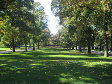
I find that Portland has done a good job balancing development, multi-mode public transit, walkable neighborhoods, and Washington and Forest Park both within the city limits. On our two days in Portland we basically walked everywhere and never really needed to jump on the streetcar, light rail, or bus.

Although it is nothing fancy I really do enjoy the waterfront in downtown Portland. It is basically a simple promenade with a nice walkway and benches. It is a draw for runners, joggers, and bikers as it becomes a pathway onto and off of the bridges. I always enjoy the ways Portland reclaims its street space.


As with all cities, Portland is far from perfect. While they fought against a highway along the waterfront, the I-405 and I-5 cut through downtown Portland and East Portland respectively. Even though this is a minor complaint, when crossing over the 405 by foot Portland has only built a sidewalk on one side, which forces you to cross the street to cross.

I was not so impressed with the downtown bike infrastructure. While during rush hour you see tons of cyclists coming off of the bridges, at some points they are left on their own with no clear signage or bike lane. While this might not be a huge problem, having logical connections always makes riding a lot easier.

Or maybe I liked Portland best on this trip because we had two glorious days of sunshine.

Wednesday, October 8, 2008

Seattle, WA

Population - 594,210
Population Density - 7,085/sq mi
Metropolitan Population - 4,038,741
I liked Seattle for what is could be, not so much for what it is. On our trip we spent the most time in Seattle and its Environs. Our friends have moved to Seattle over a year ago from NYC so we were eager to see how life has changed living on the other coast. I hate to say, not all that much.

While Seattle has what you'd expect from any NW city, it was lacking in many ways. The bike infrastructure was almost non-existent. The downtown area and bordering neighborhoods had lanes, but the city clearly lacked a bike network. (Think of NYC with the outer 4 boroughs having zero bike lanes and parking.) Seattle is very hilly and not the most walkable place because of this. At one point we tried to use the elevator to get from the waterfront to Pikes Market. Well the elevator didn't work and the couple with a stroller had to carry it up three flights of stairs.


Mono-rail and street car aside (new light is being built), Seattle public transit is okay, but from where our friends lived it took an hour plus by bus and about 15 minutes by car to get downtown. Our friends complained that the commuter rail (the Sounder) does not run often and there is no stop by them. Although they chose this location, their concerns are still valid for a city like Seattle.


The biggest disappointment had to be the lack of inviting public spaces. When we went to Pioneer Square a car was in the middle and the rest of the square was filled with homeless people. Now I don't suggest Seattle go Giulaini on them, but a clear effort needs to be made to have these be public vibrant spaces. And where are all the benches?


Seattle did have some great parks and neighborhoods that I enjoyed spending time in. Like Portland, it is great to hit a trail within the city limits. Also, having spent some time in different neighborhoods they did have a nice fabric that one would expect. I really enjoyed Greenwood Lake and the Locks, as well as the Capital Hill area. In a city the size of Seattle, public transit improvements need to really be a major priority.

Tuesday, October 7, 2008

Vancouver, BC

City Population - 611,869
Population Density - 13,817.6/sq mi
Metropolitan Population - 2,524,113
I was very excited to visit Vancouver. It had left a great impression when I last visited in 1999 and I was eager to see what is usually labeled one of the most livable cities in Canada. Our time in Vancouver was limited and although it was going to be a wet day, we made the best of it.

My first impression coming in on the bus lived up to all the things I heard about traffic congestion problems. I tend not to believe these stories since living in NYC traffic congestion has become a way of life, but it took us a good hour and a half to get downtown. What is always the worst part is you can see the skyline as it slowly sneaks up.


Because of the rain, we got the chance to take the bus and skytrain. I really liked how they had C - Commuter buses which were smaller and had routes that were off the electric lines (which is how the buses run, if you haven't been think San Francisco).

What seemed to me the biggest change from my last visit was the clear difference in the haves and the have nots. Much like NYC, it was clear that distinct classes of people lived in different areas. The lower lying land that was near the water tended to be luxury condos with garages for people's expensive cars. Having walked a good amount of downtown Vancouver, it became obvious that a real homeless and substance abuse problem existed.


Unlike Seattle and Portland I found that pedestrian safety, despite lots of traffic calming, wasn't that great as drivers were more aggressive in Vancouver than the rest of the Pacific NW. I do like the funky feel that Vancouver has and the great way it actually uses the water around it to have ferry services.

Overall I did like Vancouver but it did not live up to the expectations I had for it. While I could blame the city, it was more about the livability and quality of life, and while it clearly was not bad, it seemed far off from all the recognition it gets.

Saturday, October 4, 2008

What did you do this summer?

Here is a snippet of what I was doing:

Friday, October 3, 2008

Victoria, BC

City population - 78,659
Population Density - 10,351.9/sq mi
Metropolitan Population - 330,000
Victoria was the little city that won me over. When we last visited in 1999 we only spent one day and night in Victoria. I had the perception that it was a small city with a downtown that held BC's capital. Returning this time I found a vibrant urban city that had so much to offer. The first thing that struck me was the commercial corridors.

Douglas and Government Streets were alive with people and had a nice mix of commercial shops, retail, food, and restaurants. It was easy to walk these strips and drivers were giving pedestrians the right of way. We ended up at a great chocolate shop, coffee shops, and a few good restaurants just by walking by. This is the kind of street and sidewalk activity you want in a city. I really liked the quaint little alley ways.


We stayed in West Victoria and had a nice trail that took us to our guest house. On the Friday that we headed back into town for dinner I was amazed at the amount of cyclists that were coming off of the John Street Bridge and onto the path to head home.


Our guest house was on the water which made for a great view with the morning coffee. We took advantage of this and did some boating out in the water. Even though it was about a 40 minute walk into town, taking the trail into town was much more enjoyable than taking the bus (we did not use a car on this trip).


Finally, no Victoria visit would be complete without a trip to Butchart Gardens. We made sure to make it to the gardens our last day before we caught the Ferry back to Seattle.


Overall I enjoyed Victoria and got the sense (despite it being a huge tourist destination) that it is a pretty livable and vibrant place to live but on a much smaller scale than we are used to in the U.S. Having lived in a few major cities, places like Portland and Minneapolis tend to feel small in comparison, but Victoria almost had a small town feel with most of the advantages of a big city. I think we will definitely make a return trip in the near future.

Thursday, October 2, 2008

Franklin Avenue Make-Over


Check out the ideas over at this blog about making over Franklin Avenue in South Minneapolis. I really like the creative ideas they are throwing out. Here are a few:


Wednesday, October 1, 2008

Move over PDX


I came across this article at MPLS Bike Love. Is Minneapolis going to give Portland a run for its money in the number 1 spot for the most bike commuters?
The number of Minneapolis workers who commute by bicycle jumped 49 percent in 2007, according to a city report highlighting recently released U.S. Census Bureau estimates. About 7,200 city residents biked to work in 2007, up from about 4,840 in 2006.

Maybe those reports of Midtown Greenway traffic jams weren’t exaggerated. Among the nation’s 50 largest cities, Minneapolis trails only Portland, Ore., in the percentage of people who bike to work, the Census Bureau reported. About 3.8 percent of commuters rode bicycles in Minneapolis, compared to 3.9 percent in Portland.

Also of note:
Minneapolis also ranked high in other forms of green commuting.

Census data indicated about 12,000 people, or 6.4 percent of residents, walked to work last year, putting Minneapolis 9th among the 50 largest cities. Minneapolis ranked 10th in public transportation ridership with more than 25,000 commuters, or about 13.4 percent of residents, riding a bus or light rail train to work.

By comparison, the city ranked 40th for the number of people who drove alone to work.
The commuting estimates have a margin of error of plus or minus 0.8 percent. The data was gathered from long-form Census Bureau surveys completed by about 5,050 city residents in 2007.

Is Minneapolis a green alternative transportation center that has been flying under the radar? We usually look to cities like New York or San Francisco for these sort of livable cities. While Portland still is the leader in many ways, it will be interesting to see what effects the central corridor and other projects will have on Minneapolis residents commuting habits.